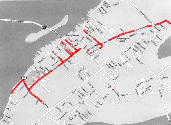
Chincoteague Island Map
Location of Black Residences
Below is a map of current day Chincoteague with the streets where black families lived marked in red. These locations are taken from the 1910-1930 US Census. Without an extensive search of ownership and deeds, it is impossible to know exact location of houses, therefore, the entire streets are marked. Given the change in names and locations of many Island streets in the intervening years, there is a degree of uncertainty in some of these locations.
The location of several other sites of black history also have been indicated on the map:
1. Freewill Methodist Episcopal Church (1874)
2. The black schoolhouse (ca 1886)
3. Christ Union Baptist Church (1876) and Cemetery
4. Odd Fellows Cemetery


